


CLARKSVILLE Voting District, Butler County, Iowa
About
Outline

Summary
| Unique Area Identifier | 581613 |
| Name | CLARKSVILLE Voting District |
| County | Butler County |
| State | Iowa |
| Area (square miles) | 1.37 |
| Land Area (square miles) | 1.33 |
| Water Area (square miles) | 0.04 |
| % of Land Area | 97.20 |
| % of Water Area | 2.80 |
| Latitude of the Internal Point | 42.77917620 |
| Longtitude of the Internal Point | -92.66840350 |
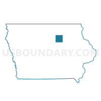
Maps

Graphs
Select a template below for downloading or customizing gragh for CLARKSVILLE Voting District, Butler County, Iowa


Neighbors
Neighoring Voting District (by Name) Neighboring Voting District on the Map
- BUTLER TWP W/O CLARKSVILLE Voting District, Butler County, IA
- JACKSON TWP W/O ALLISON & CLARKSVILLE Voting District, Butler County, IA